

Explore the past and present of South Wheeling’s landscape through helpful maps available here!
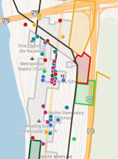
MapHub Interactive Map of South Wheeling
This map includes all types of buildings and complexes in South Wheeling’s history, including structures still standing and those that have been lost. Map icons indicate property use and themes, including homes, factories, small business, and civic/religious properties.
This map is a living digital document, with plans to modify and add into the future. Notice an absence or a error? Let us know and we’ll make proper corrections!

MapHub Interactive Map of the Brewing Industry of South Wheeling
This map includes only properties related to the history of the Brewing Industry in South Wheeling, including the Schmulbach complex, Uneeda Brewing, and bar/saloon vendors. This map also provides a suggested self-guided walking tour of a majority of the sites available!
This map is a living digital document, with plans to modify and add into the future. Notice an absence or a error? Let us know and we’ll make proper corrections!
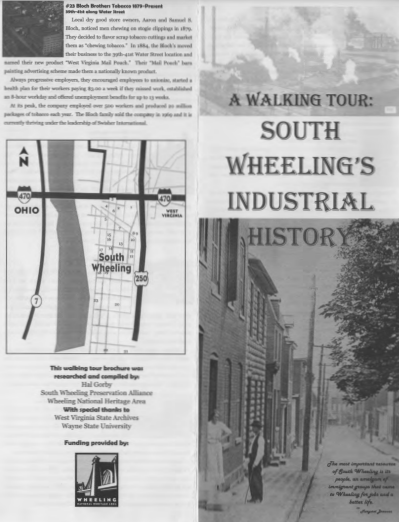
Wheeling Heritage’s South Wheeling Industrial History Walking Tour
This is a printable self-guided walking tour leaflet that focuses on the industry history of South Wheeling, including the factories, workers, community, and unions during the height of South Wheeling’s manufacturing history. Further details on locations and people are provided in 1-2 paragraph blurbs.
This guide was made several years ago and several of the sites it includes have since been demolished.

Wheeling Heritage’s Schmulbach Brewing Complex Walking Tour
This is a printable self-guided walking tour leaflet that focuses solely on the Schmulbach Brewery Complex and a timeline of Henry Schmulbach’s life. Labeled photographs and 1 paragraph blurbs on buildings are included.
The Schmulbach Brewery complex is a small self-contained complex, this guide will be easy to follow and a short activity.

F. W. Beers & Co. 1871 Map, available at Ohio County Public Library
Map of the City of Wheeling, South Wheeling and La Grange West Virginia.
From actual surveys by Jas. Gilchrist, C. E., published by F. W. Beers & Co., 1871.
Map available both as a high quality scan on the Ohio County Public Library website (linked below) as well as physical copies by appointment.
NOTE: The Library’s copies of this map are large-scale photocopies. The Library does not own an original print of this map.